Magnitude 8.2 quake off Mindanao triggers Pacific tsunami alerts
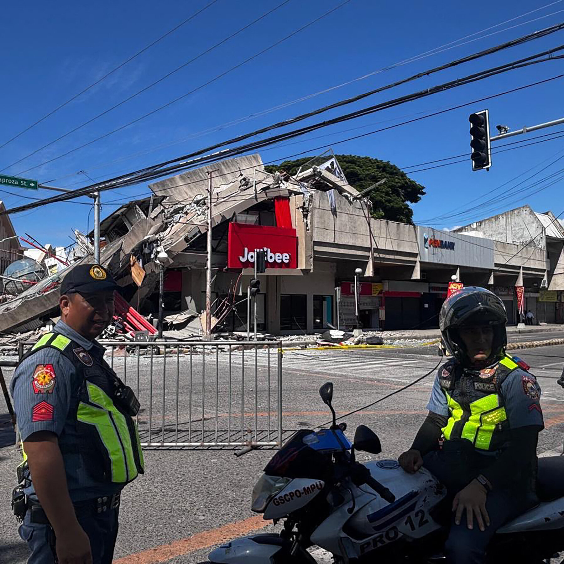
A magnitude 8.2 earthquake struck off the southern coast of Mindanao in the Philippines at 23:48 UTC on 7 June 2026, according to alerts aggregated by regional watch channels and broadcast by The Spectator Index via @osintlive, triggering tsunami advisories across a wide arc of the western Pacific within minutes of the initial shock. Alerts were issued for the Philippines, Indonesia, Palau, Yap, Taiwan and Papua New Guinea, an arc spanning more than 4,000 kilometres of coastline and covering both heavily populated archipelagos and thinly-administered US Compact of Free Association states.
By 00:13 UTC on 8 June, the bulletins in circulation remained in advisory status for most of the affected jurisdictions, according to reports aggregated by @wfwitness. The geographic spread of the alert — simultaneous warnings from the Philippine Trench to the Mariana Islands — is itself the story. The western Pacific sits on the most seismically active belt on the planet, and any large-magnitude subduction event in the Philippine Trench carries downstream consequences for an entire ocean basin.
A magnitude 8.2 subduction event in the Philippine Trench is, by historical standards, a significant but not unprecedented occurrence. What the current alert has exposed is a regional gap. Upstream tsunami early-warning infrastructure is more sophisticated than it was a generation ago; downstream civil-defence coordination across the smaller Pacific island states remains patchy at best, a fact the current bulletins will not fix.
What the bulletins actually say
The Spectator Index, citing the Pacific Tsunami Warning Center, classified the threat as "widespread" but reserved the highest-level warnings for coastlines within 1,000 kilometres of the epicentre, according to the @osintlive feed. The bulletins relayed by @GeoPWatch named Palau, Papua New Guinea, the Philippines, Taiwan and Yap as the most exposed jurisdictions, with smaller wave amplitudes expected further out given the longer fetch and the bathymetry of the receiving basins.
The first hour of any tsunami event is the noisiest, and conflicting early readings are the rule rather than the exception. The distinction between an advisory and a warning matters operationally: an advisory tells coastal populations to stay out of the water; a warning tells them to move. The current bulletins, as of 00:13 UTC, sit in the lower band for most of the affected jurisdictions — a calibration that, if correct, preserves public compliance for the next time, and if wrong, will be measured in lives.
There is no public confirmation yet of casualties, structural damage, or significant wave run-up. The sources available in the immediate aftermath do not specify the depth of the mainshock or the precise fault mechanism, which makes any forward-looking damage estimate premature.
The precedent — and the silence
The Philippine Trench has produced multiple large earthquakes over the past century, and the regional scientific community has, over time, accumulated an unusually dense body of data on how the trench behaves. The 2011 Tōhoku event in Japan, by contrast, demonstrated that even a sophisticated early-warning architecture can fail to deliver the right information at the right scale when the worst case exceeds the planning envelope. The current bulletins, by general reckoning, fall well inside the planning envelope for a magnitude 8 subduction event, and there is no indication in the initial reporting that the alerts have been mis-scaled in either direction.
What is striking in the present case is the near-total absence of on-the-ground reporting from the smaller affected jurisdictions — Palau, Yap, the Papua New Guinea outlying provinces. These are places where the press presence is thin and the institutional capacity to issue a steady stream of situation reports is limited. Smaller Pacific disasters have illustrated the same gap repeatedly: when the Pacific tsunami system's periphery is the target, the information flow thins out quickly.
The pattern is not new, but the current alert exercises it in real time, and the bulletins reveal the asymmetry between a well-funded, real-time scientific upstream and a downstream response architecture that is unevenly resourced across the affected jurisdictions.
Structural frame: who pays for the perimeter
The Pacific tsunami warning architecture is a layered system. The Pacific Tsunami Warning Center in Hawaii provides the primary scientific product for most of the basin; the Japan Meteorological Agency and the Russian services cover the northern Pacific; Australia and New Zealand cover the southwestern Pacific through their own national agencies. UNESCO's Intergovernmental Oceanographic Commission provides the coordination layer.
The system's center of gravity is the well-funded, well-staffed warning centers. Its weak point is the perimeter — the small island states, the eastern Indonesian provinces, the outlying PNG provinces, where the hazard models are less granular, the tide-gauge networks are sparser, and the civil-defence organisations are smaller and more dependent on donor funding.
A further structural feature: the most vulnerable populations are, almost without exception, the most economically peripheral. The Philippine cities of Davao and General Santos have invested in vertical-evacuation infrastructure; the smaller municipalities and the fishing villages along the Moro Gulf have not, for the same reason that the smaller Pacific islands have not — cost, governance capacity, and a long history of false alarms that erodes public compliance.
The geopolitical undercurrent is harder to name but worth marking. US Compact of Free Association arrangements with Palau, the Federated States of Micronesia and the Marshall Islands grant the United States exclusive strategic access in exchange for, among other things, federal disaster response. Whether those provisions move in real time, or only after the headlines have moved on, is a question the current event will stress-test.
Stakes
The next six to twelve hours will determine whether this event becomes a footnote in the regional seismological record or the start of a sustained emergency. The immediate operational question is whether the wave amplitudes track the forecast envelope or exceed it; the longer-term question is whether the smaller affected jurisdictions have the capacity to mount a credible response if they do.
For the Philippines in particular, the political question is whether the national disaster response capacity holds at the municipal level. The country has rebuilt its disaster response architecture since Typhoon Haiyan, but the chain of command between national and local government is structurally fragile, and the question of whether it can move coastal populations to high ground in the dark, in the rain, with limited communications, is the test that the next few hours will run.
For the smaller Pacific states, the test is more fundamental: whether the alert-and-response chain that nominally exists on paper actually moves people in the dark. The bulletins are working. The downstream question — what happens after the first wave arrives — is the one the early-warning system cannot answer.
Desk note: Monexus is treating this as a developing story. The article reflects the bulletin state as of 00:13 UTC on 8 June 2026. The absence of detail on smaller jurisdictions is itself a finding, not a gap in our reporting. We will update as wave data, casualty reports and on-the-ground accounts become available.
Wire provenance
This editorial synthesis draws on the following public wire/social posts:
- https://t.me/wfwitness
- https://t.me/osintlive
- https://t.me/GeoPWatch