Magnitude-7.1 Quake Shakes Northern Venezuela as USGS Issues Tsunami Advisory
A magnitude-7.1 earthquake struck northern Venezuela on 25 June 2026, prompting a USGS tsunami warning for the Caribbean coastline and drawing emergency-response attention from Caracas through the Lesser Antilles.
A magnitude-7.1 earthquake struck northern Venezuela in the early hours of 25 June 2026, the United States Geological Survey (USGS) confirmed, shaking the capital Caracas and prompting the agency to issue a tsunami warning for the Caribbean coastline. The quake originated at a depth of 13.2 kilometres, according to USGS data relayed by regional outlets, and was felt across a wide swath of the country in the minutes after impact. Cuban state outlet CubaDebate reported the tremor on the morning of 25 June, citing USGS figures, while Iranian state-run outlets Tasnim and Fars carried the warning to their respective audiences within minutes of the American agency's bulletin.
The event, with its epicentre placed in northern Venezuela, has put the Caribbean Basin on alert. The USGS tsunami warning — issued in the hours after the main shock — covers the Venezuelan coast and adjacent islands. At this stage, the depth and magnitude parameters are consistent with a shallow, crustal event capable of producing significant local shaking, and the warning reflects a precautionary posture rather than confirmation of wave damage. The Caribbean has long experience with seismically generated tsunamis, and the regional response architecture is now visibly engaged.
What the USGS reported
According to the United States Geological Survey, the earthquake registered a magnitude of 7.1 and struck at a depth of 13.2 kilometres. CubaDebate, citing the USGS, placed the event on Wednesday morning in Caracas — a frame corroborated by TeleSUR English, which posted on X at 23:53 UTC on 24 June 2026 that "a powerful earthquake struck Venezuela on Wednesday, according to the United States Geological Survey," with the 7.1 magnitude and 13.2-kilometre depth figures matching. The consistency of the parameters across multiple relays — Cuban, Iranian and Venezuelan state media — points to a single USGS event page, the canonical source for the technical reading.
The depth figure matters. A 13-kilometre hypocentre is shallow by global standards, where the average continental crustal event sits closer to 15–30 kilometres, and shallow ruptures of this magnitude typically produce stronger surface shaking and a higher likelihood of tsunami generation when the rupture occurs offshore or under coastal water. The USGS issued a tsunami warning on Thursday morning, in the immediate aftermath of the main shock, in line with its standard protocol for shallow events of this magnitude class near a coastline.
A regional response activates
Within minutes of the USGS bulletin, the warning was carried in English and Spanish across Caribbean and South American media, and was picked up by outlets in the Middle East — including Tasnim and Fars in Iran, both of which translated the key parameters (7.1 magnitude, tsunami warning, northern Venezuela) into Persian-language coverage on 25 June 2026. The speed of relay reflects the modern disaster-information chain: a single USGS event page, social distribution via X (formerly Twitter), and parallel pickup by state-affiliated outlets across three continents.
The Caribbean is no stranger to this kind of warning. The 1946 Dominican Republic earthquake and tsunami killed more than 1,800 people; the 2010 Haiti event killed an estimated 200,000–300,000; and the 2021 Haiti quake killed more than 2,200. Each of those episodes hardened the regional emergency-response infrastructure. The current advisory, by contrast, comes with a more responsive information layer — early-warning apps, SMS gateways, and a far more mature tsunami-warning centre architecture in the Caribbean, which is run from the Pacific Tsunami Warning Center and the US National Tsunami Warning Center.
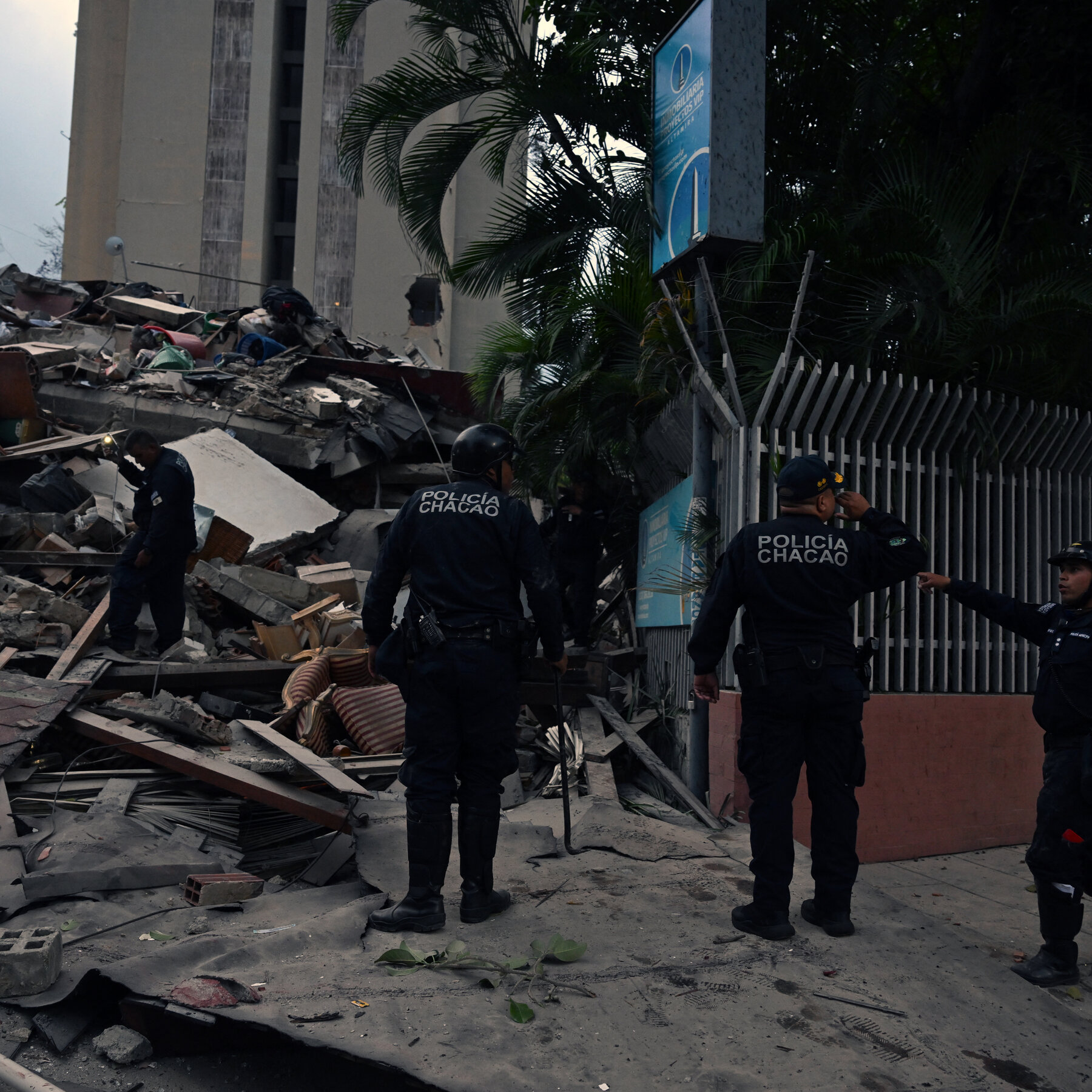
The structural variable here is governance. Venezuela's civil-defence capacity has been under sustained strain through a decade of economic contraction, hyperinflation, and political crisis, and the country's ability to mount a national-scale evacuation in coastal areas will be one of the first things under international observation in the next 24 hours. Caracas, a city of roughly three million people built on the northern coastal range, sits squarely inside the shake zone reported by users on social platforms. The combination of urban density, informal hillside construction, and the age of the building stock amplifies the casualty and displacement risk relative to the raw magnitude figure.
The Caribbean seismic setting
Northern Venezuela sits at the southern end of the Caribbean Plate's boundary with the South American Plate, a transform-and-subduction margin that runs from Trinidad westward through the Boconó fault system. The 1812 earthquake that destroyed Caracas, the 1900 event that killed dozens in the country's north, and the 1997 Cariaco quake — magnitude 6.9, ten killed — are part of the same tectonic family. A magnitude-7.1 shock in this zone is consistent with the historical record, not outside it.
The structural frame is straightforward: high-population coastal zones, mixed building stock, and a regional tsunami-warning system that issues advisories in minutes. The unknown is the rupture's exact location relative to the coast, the duration of strong shaking, and whether the offshore displacement was sufficient to generate measurable wave action. The USGS is the body of record for those technical determinations.
What remains unknown
The thread coverage available as of publication does not contain a casualty figure, an official Venezuelan government statement, a damage assessment, or confirmation of wave activity from the Pacific Tsunami Warning Center. The warning itself is precautionary, and the absence of a wave report does not mean one will not materialise — the relevant monitoring window extends for several hours after the main shock. Equally, the USGS magnitude figure of 7.1 may be revised as additional seismograph data is processed; the standard workflow allows for refinement of ±0.2 magnitude points in the first 24 hours.
This publication will update the article as soon as either the USGS revises its parameters, the Pacific Tsunami Warning Center issues a cancellation or a confirmed wave observation, or Venezuelan civil-defence authorities publish a formal damage assessment. The public-information layer is functioning faster than at any point in the historical record; the question for the next 24 hours is whether the warning infrastructure behind it can convert that information into action on the ground.
This article relies on USGS data as relayed by Cuban, Iranian, and Venezuelan state-affiliated media. The agency of record for magnitude, depth, and tsunami advisories remains the US Geological Survey; this publication will correct any parameter that diverges from the USGS event page.
Wire provenance
This editorial synthesis draws on the following public wire/social posts:
- https://t.me/CubaDebate
- https://t.me/tasnimnews_en
- https://t.me/farsna
- https://t.me/FarsNewsInt